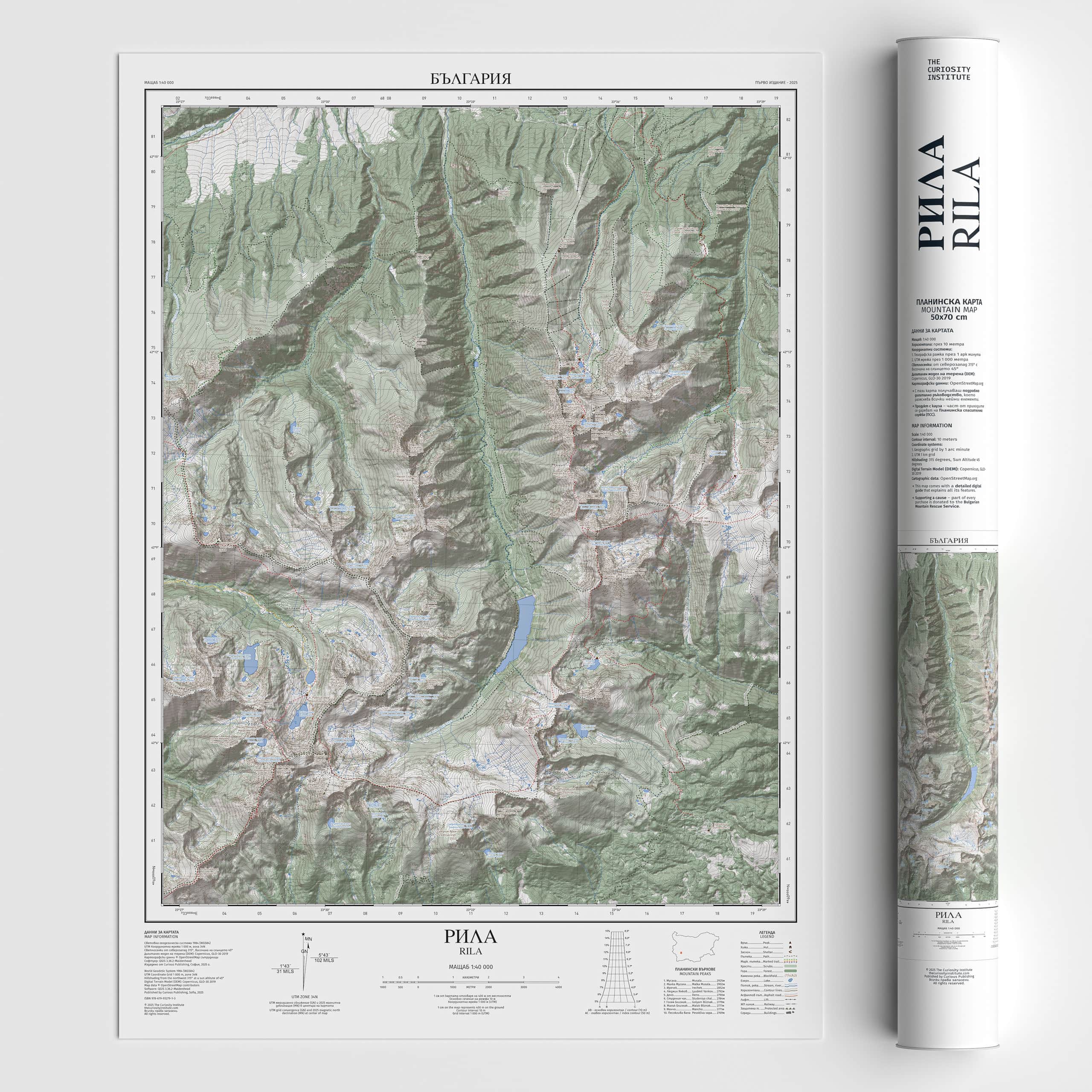
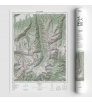
Mountain Map Rila 50/70
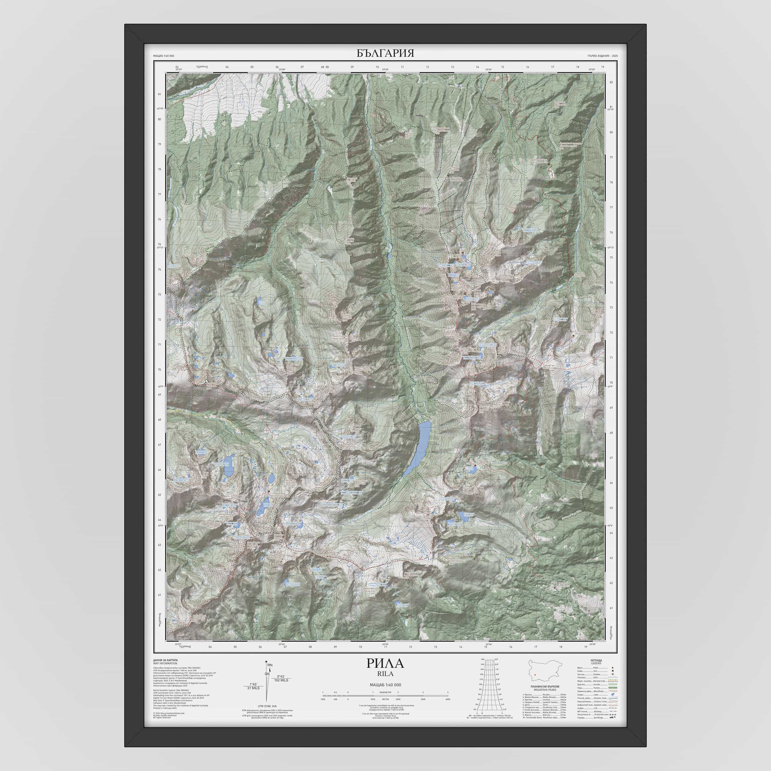
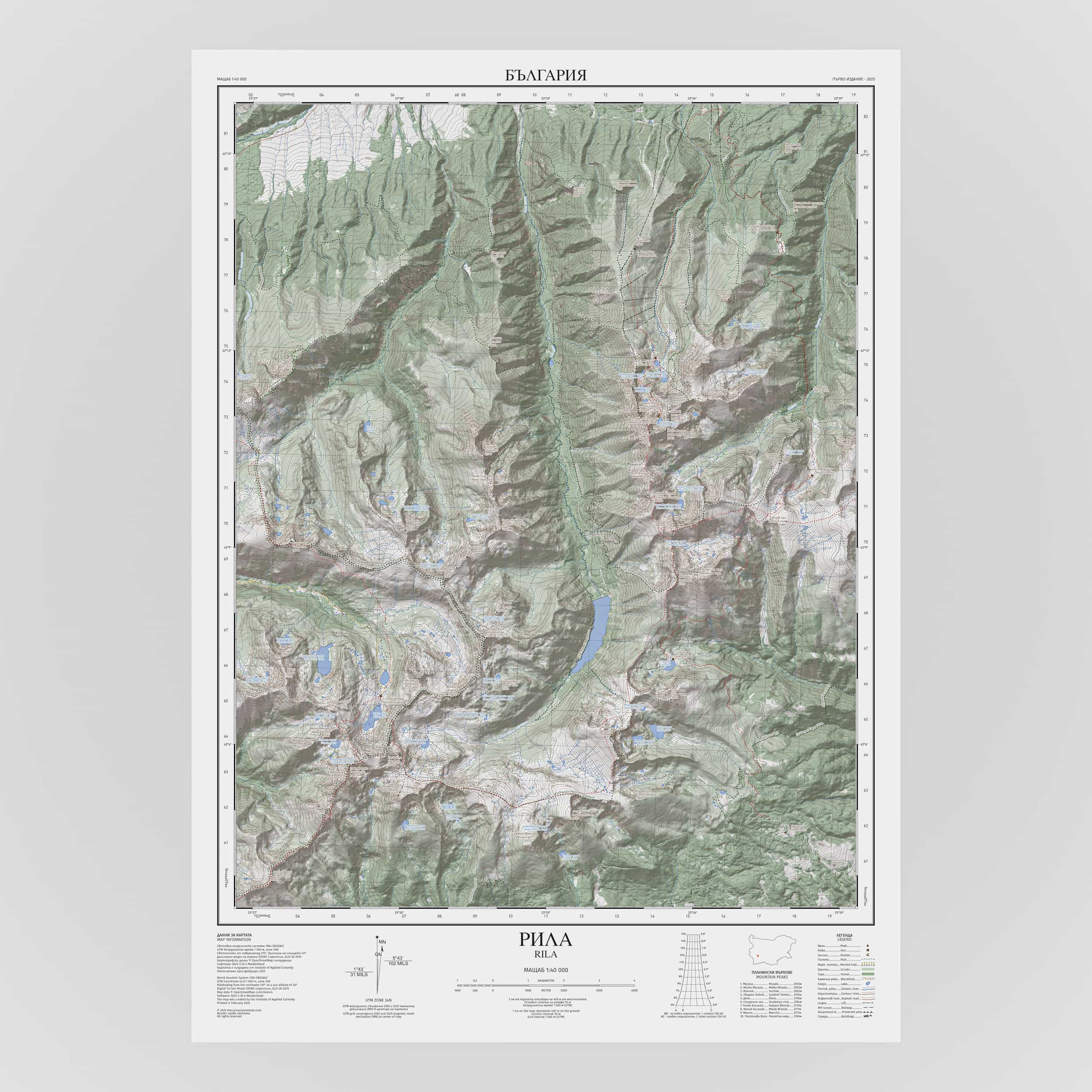
Rila – a mountain of vast ridges, glacial lakes, and the highest point in the Balkans – Mount Musala.

Rila – a mountain of vast ridges, glacial lakes, and the highest point in the Balkans – Mount Musala.
SKU: 9786199327913
The map is at a 1:40,000 scale, where 1 cm on the map corresponds to 400 meters in reality. It features contour lines at 10-meter intervals, with shaded relief illuminated from 315° (northwest) at a 45° sun angle. Terrain, peaks, hiking trails, huts, shelters, lakes, and rivers are depicted in a way that enables quick orientation and a clear understanding of the landscape.
The map allows orientation using:
A geographic coordinate grid (latitude/longitude) with divisions every 1 arc minute, labeled every 3 minutes, with each minute subdivided into 12 arc seconds;
A Universal Transverse Mercator (UTM) grid with 1,000-meter spacing, superimposed on the terrain.
Additional elements include:
Legend;
List of the ten highest peaks;
Scale bar;
Slope diagram for calculating the average slope of a selected segment;
Diagram showing true north, magnetic declination and the deviation of the UTM grid from true north.
The map deliberately includes only carefully selected cartographic elements to achieve clarity and focus.
With every order, you’ll also receive a detailed digital guide to help you interpret every element of this map.
Detailed description
The map is at a 1:40,000 scale, where 1 cm on the map corresponds to 400 meters in reality. It features contour lines at 10-meter intervals, with shaded relief illuminated from 315° (northwest) at a 45° sun angle. Terrain, peaks, hiking trails, huts, shelters, lakes, and rivers are depicted in a way that enables quick orientation and a clear understanding of the landscape.
The map allows orientation using:
A geographic coordinate grid (latitude/longitude) with divisions every 1 arc minute, labeled every 3 minutes, with each minute subdivided into 12 arc seconds;
A Universal Transverse Mercator (UTM) grid with 1,000-meter spacing, superimposed on the terrain.
Additional elements include:
Legend;
List of the ten highest peaks;
Scale bar;
Slope diagram for calculating the average slope of a selected segment;
Diagram showing true north, magnetic declination and the deviation of the UTM grid from true north.
The map deliberately includes only carefully selected cartographic elements to achieve clarity and focus.
With every order, you’ll also receive a detailed digital guide to help you interpret every element of this map.